Western US Hydroclimate
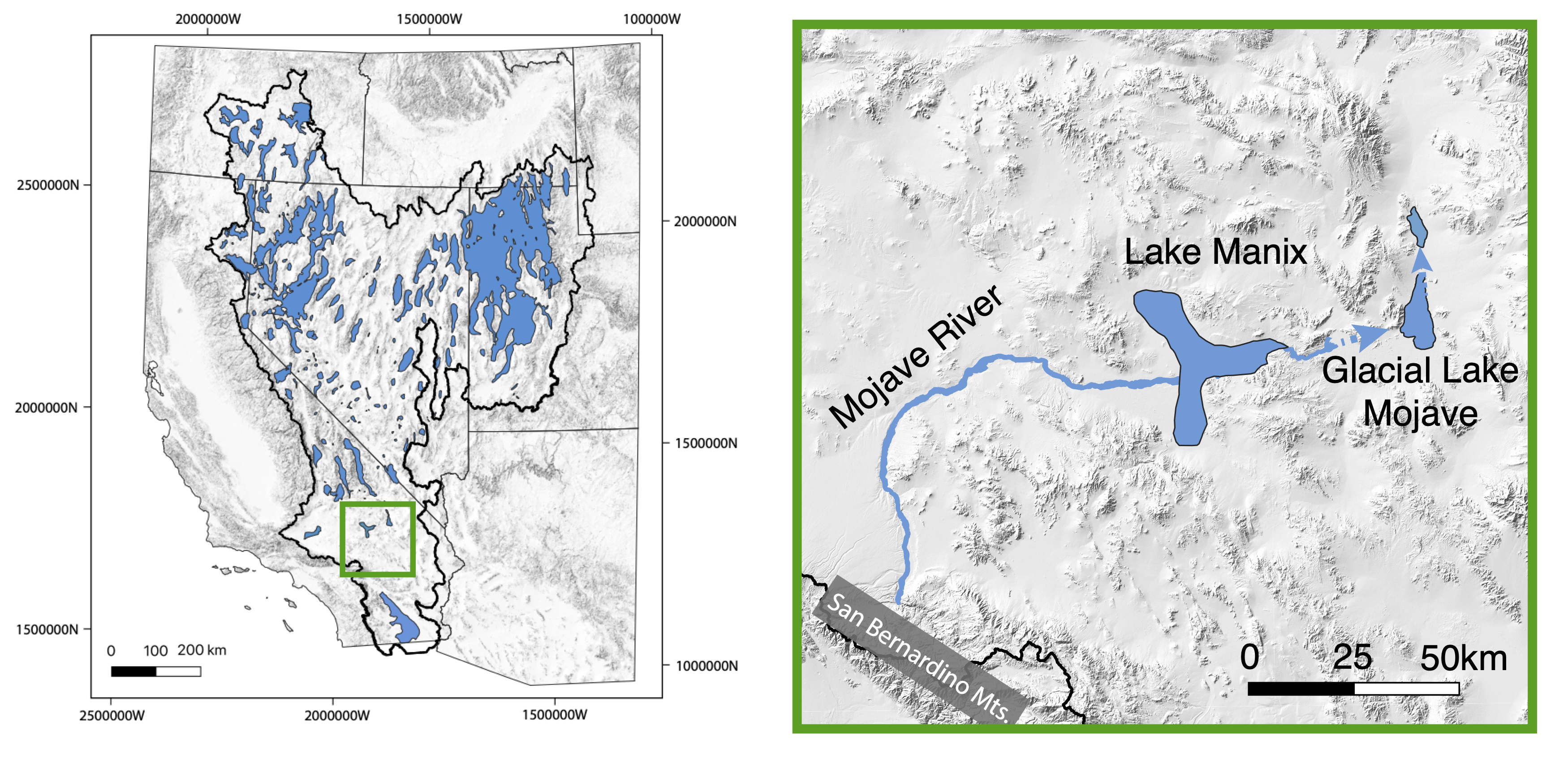
The Great Basin in the western US is currently one of the driest regions in North America, but has also contained large and abundant lakes during times throughout the Quaternary, most recently during last glacial maximum (~26-20ka) and subsequent deglacial period, lasting until ~10 thousand years ago. Understanding the climate forcing that drove these changes in water balance through time is important for determining how changing climates will affect surface water availability in arid regions.
 (Left) Map of the Great Basin with blue regions showing the locations of paleolakes at the Last Glacial Maximum. (Right) Inset map showing the location of the Mojave River system and paleolakes Manix and Mojave
Glacial Lake Mojave
I am working on a project in collaboration with researchers at Cal State Fullerton and Santiago Canyon College studying Glacial Lake Mojave (GLM): a pluvial lake in the southern Great Basin. Using a “core-to-shore” approach we are reconstructing the lake history using proxy records from a sediment core at the lake depocenter, as well as tufa and shells from ancient shoreline deposits.
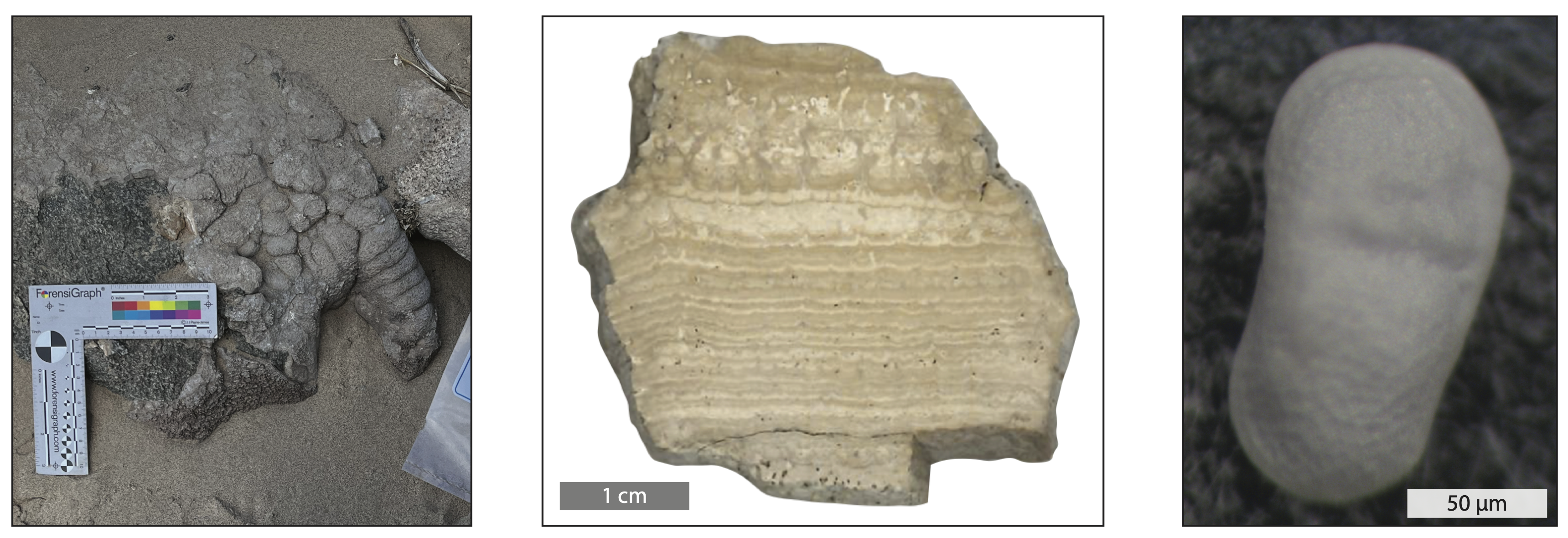
 Ancient shoreline deposits from GLM
I am combining carbon and oxygen stable isotope measurements, radiocarbon and U-series geochronology, and elemental analyses (e.g. magnesium, calcium, and strontium) on ostracods and tufa from GLM to reconstruct lake levels and conditions over the past 25 ka. When paired with climate model outputs and geochemical models describing lake conditions, these data will allow us to reconstruct the hydroclimate forcings that have controlled water balance in the southern Great Basin since the Last Glacial Maximum.
 (Left) Example of in situ tufa deposit at GLM. (Middle) Layered tufa sample from GLM, which grew over an approximately 4000 year depositional period. (Right) GLM fossil ostracod
